|
Iran Carte routière - Road map - Country maps - Länderkarten |
|
Iran Carte routière - Road map - Country maps - Länderkarten |
République
islamique d'Iran - Islamic Republic of Iran
Islamische Republik Iran
Moyen Orient - Middle East

|
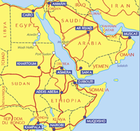
1 / 4.000.000 Egypte, Erythrée, Soudan, Ethiopie, Kenya, Arabie Saoudite, Irak, Iran, Yemen Légende en : Anglais Allemand Arabe Italien Français
Egypt, Eritrea, Sudan, Ethiopia, Kenya, Sausi Arabia, Iraq, Iran, Yemen A road map of Northeast Africa and Arabia, covering the major road networks across the region. Scale: 1/4,000,000 - 1cm=40km Legend/Key in three languages Editeur : Michelin - Carte - Atlas - carte |
|
|||
|
Atlas routier - Guide touristique - Road Map - Travel Guide |
||

|
Middle East By Cartographia
1 : 4.000.000 Map of the region is printed in color on
one side. Cartographia is a world-class Hungarian publisher of country and city maps, specializing in Europe, Eastern Europe, and Africa. One way Cartographia has distinguished themselves is by mapping areas of the world that other publishers ignore. All maps are exquisite in their use of color for elevation, and show complete transportation networks. City maps have building and Central Business District detail along with subway or local trains if applicable. Each map is fully indexed, and country maps have insets of all the major cities.
|
|

|
Greater Middle East Region
Laminmated Map
Follow events in this volatile region in our new, historically annotated map of the Greater Middle East, extended to include Afghanistan and Pakistan. Map is available in two formats, paper folded to pocket size (4" x 9") or laminated (38" x 25"). Presentation features a detailed political map, a physical map of the area showing both land and water relief, an up-to-date historical chronology of the area, an annotated historical map illustrating the political changes from 1945 to the present, and a location index. It's the ideal reference in understanding this complex and vital area of our world.
Publisher: Hammond |
|

|
Iran By International
Travel Maps
Scale 1:2,500,000. A map from ITM is an all-in-one travel resource, and perfect for today’s travelers! These attractive and information-rich maps cover an entire country/region in splendid detail. Useful information such as elevation, major transportation routes, and national parks is clearly displayed.
|
|

|
Near & Middle East
International Road Map
The Hammond International Series of travel maps feature state-of-the-art digitized mapmaking to ensure an unparalleled degree of accuracy. All city maps feature regional insets and all country maps feature city insets. Both maps and atlases are printed on high quality paper, with sturdy covers for increased durability. Each map also contains a comprehensive index. Publisher: Hammond
|
|

|
Iran de Guide Olizane
Aventure
A mi-chemin entre l'Asie et l'Europe méditerranéenne, l'Iran possède un héritage archéologique et culturel très riche. Pendant plus de trois millénaires, le pays a été un lieu de rencontres entre civilisations et de migrations : centre du premier grand empire mondial sous Cyrus, la Perse fut envahie tour à tour par les Grecs, les Arabes, les Mongols et les Turcs, mais n'a jamais perdu son identité propre ni son originalité, absorbant à chaque fois l'envahisseur et apportant à celui-ci une richesse philosophique et artistique, scientifique et religieuse qu'il n'avait jamais connue. L'Iran ne se résume pas à ce passé glorieux : après une révolution et dix années de guerre, cette république islamique shi'ite s'inscrit aujourd'hui parmi les grandes puissances de cette partie du globe. Cet ouvrage permet au voyageur d'aborder les complexités culturelles et historiques, et de mieux en percevoir les développements récents. Outre les renseignements pratiques nécessaires à la préparation du voyage, le lecteur y trouvera des extraits littéraires et des textes traitant en détail de sujets particuliers tels que l'architecture, la calligraphie islamique ou la poésie persane. Nombreux plans de sites et de villes. Editeur : OLIZANE
|
|

|
Iran de Guide Lonely Planet (en anglais) 57 Maps From its celebrated Persian palaces and turquoise-tiled mosques to its clay-baked caravanserais and exotic bazaars, Iran has long tantalised travellers fascinated by the Islamic world. Explore all of this country's secrets - and more - with this fully updated guide. 57 detailed maps, plus a full-colour country map illustrated sections on arts, carpets, Persepolis and Esfahan extensive historical, political and cultural notes the latest on border crossings, no-go areas and the best way to get around Farsi language chapter and script for all place names Lonely Planet Publications Ltd |
|
|
|
Iran - Lonely Planet -
Fr
Si les palais de Shirâz ou les coupoles d'Ispahan invitent à la découverte de la Perse ancienne, l'Iran d'aujourd'hui permet mille et un voyages : des rives de la mer Caspienne aux montagnes du Zagros, laissez-va surprendre par ce pays encore secret.
Editeur : Lonely Planet |
|

|
Iran - Le
Petit futé
L’Iran : un pays grand comme trois fois la France, près de 70 millions d’habitants, un territoire constituée en grande partie de hauts plateaux semi-désertiques s’étirant vers l’infini des steppes d’Asie centrale, borné à l’est par les vestiges du « mur d’Alexandre le Grand » contemporain de la Grande muraille de Chine. Le Petit Futé - Guide Le Petit Futé |
|

|
Iran. Kunst - Reiseführer
Der Band führt den Reisenden von der elamischen Metropole Susa zur achämenidischen Residenzstadt Persepolis; vorbei an mittelalterlichen Wüstenstädten geht es zu den farbenprächtig verzierten Bauten der safawidischen Königsstadt Isfahan. 400 Seiten - Dumont Reiseverlag |
|

|
KulturSchock Iran
Wer heute in den Iran reist, sei es aus geschäftlichen oder touristischen Gründen, kommt nicht umhin, sich mit den Gegebenheiten im Land und insbesondere dem schiitischen Islam auseinanderzusetzen. Die Autorin hat den Iran lange bereist und bietet Erklärungen und Hinweise, ohne die die aktuelle Situation im Land kaum zu verstehen ist. Das Buch beschreibt die Denk- und Verhaltensweisen der Einwohner, erklärt die geschichtlichen, religißsen und sozialen Hintergründe, die zu diesen Lebensweisen führen. Familienleben, Moralvorstellungen und Anstandsregeln werden genauso erläutert wie Umgangsformen, religißse Gebote oder Tischsitten. Davon abgeleitet werden Empfehlungen für den Reisealltag, z.B. im Hotel, unterwegs, beim Einkaufen und beim alltäglichen Umgang mit den Einwohnern des Gastlandes. 240 Seiten - Reise Know-How Verlag |
|

|
Iran : The Bradt Travel Guide
Travellers with an interest in the art, history and culture of Iran will be delighted with this new guide, which covers all the practicalities of travel to this increasingly accessible country and much more. This full-length Bradt guide shows the visitor where to go, what to see and how to behave in order to get the most out of a trip. On the practical side, every aspect of travel in Iran, from getting a visa and choosing a tour operator to cultural awareness and religious sensitivity, is covered. Editeur : BRADT Travel Guides |
|


| Capital : Tehran Administrative divisions: 28 provinces (ostanha, singular - ostan); Ardabil, Azarbayjan-e Gharbi, Azarbayjan-e Sharqi, Bushehr, Chahar Mahall va Bakhtiari, Esfahan, Fars, Gilan, Golestan, Hamadan, Hormozgan, Ilam, Kerman, Kermanshah, Khorasan, Khuzestan, Kohkiluyeh va Buyer Ahmad, Kordestan, Lorestan, Markazi, Mazandaran, Qazvin, Qom, Semnan, Sistan va Baluchestan, Tehran, Yazd, Zanjan |
| Regionalkarte - Landkarte |
Road maps and atlases
Karten und Atlanten anbieten
Carte Nazionali
Mapas y atlas
|
Copyright © 2001-2005 |
|
|
| Container |
Plans & Guides -
Tourisme -
Road maps
-
Tourism |
|