| |
Préparez vos
voyages et séjours en
Amérique

Cartes
pays : USA - Canada - Mexique - Argentine ...
Country maps - Länderkarten - Carte Nazionali - Mapas de Países
|
|
|
| |
|
|


Chile -
Chili -
Cile |
Argentina and Chile -
Collins World Travel Map
1 : 5 000 000.
A detailed physical map showing the main
transportation links and tourist features of Argentina and Chile.
The
adjoining countries of Paraguay and Uruguay are covered, from the borders
with Peru, Bolivia and Brazil to Cape Horn and Tierra del Fuego, as are
the Easter and Falkland Islands.
Editeur : HarperCollins Publishers
Travel / Road maps & Atlases
|


|
|
|

Chile -
Chili -
Cile |
Chile - Patagonia - Nelles
Map Maßstab: 1
: 2.500.000
Enthaltene Zusatzkarten:
Detailkarte:
- Around Santiago 1 :
800.000
- Easter Island 1 : 150.000

Stadtplan:
- Antofagasta 1 : 18.000
- Arica 1 : 11.100
- Central Santiago 1 :
15.000
- Iquique 1 : 12.500
- La Serena 1 : 8.000
- Punta Arenas 1 : 10.000
Éditeur : Nelles Verlag |
|
|
|
|
|
|
|
|
|
|
|
|
|
|
|
|
|
 |
| |
|
|


Ecuador -
Equateur
Equador |
Ecuador
- Road Map Ecuador - B & B
Map
Equateur - Ecuador - Equador
Maßstab - Scale - Echelle
1:1 000 000
BERNDTSON Map, laminated road map, folded
Detailed Maps:
Ecuador Oeste 1:1 000 000,
Ecuador Este 1:2 000 000,
Islas Galápagos 1:1 300 000,
Gran Quito 1:100 000,
Quito 1:20 000,
Cuenca 1:17 000,
Guayaquil 1:17 000,
Ingapirca 1:800
Dominated by the majestic, towering Andean range, Ecuador is a country
of magnificent highlands, dramatic slopes, dense rainforests, fertile
lowlands, and - last but not least - beautiful sandy beaches.
Its immense variety of landscapes and habitats supports a unique flora
and fauna - a biodiversity almost unparalleled on earth. The highlands
north of Quito with its UNESCO heritage listed Old Town are not only
famous for their views, but also for their colourful Indian markets.
The southern highlands contain Ecuador's wildest scenery, dotted with
tiny ancient Indian villages. While nature buffs and birdwatchers may want
to explore the jungles of the Oriente, the less adventurous may fall in
love with the unspoilt beaches and picturesque fishing villages on the
Bahía de Manta. Anyone, however, should follow the lure of the magnificent
Galapagos Islands, 1000 km off the coast.
Ecuador Map, Laminierte Straßenkarte, gefaltet
Aktuelle, laminierte Straßenkarte mit diversen Nebenkarten samt
Register und einer landeskundliche Einführung in 5 Sprachen. Dieses
Produkt ist dank der Folienbeschichtung extrem robust, reißfest,
wasserfest, beschriftbar und abwischbar sowie endlos faltbar.
B&B Map, Laminierte Straßenkarte, gefaltet
Berndtson & Berndtson
|
|
|
|
 |
| |
|
|
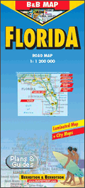
Florida -
Floride |
Florida - B&B Map
Laminated Road Map by Berndtson
Scale : 1:1 200 000
BERNDTSON Map, laminated road map, folded
Detailed Maps:
- Florida 1:1 200 000,
- Key West 1:20 000,
- Miami Downtown 1:20 000,
- South Miami Beach 1:20 000,
- Orlando &
Region 1:200 000,
- Walt Disney World 1:65 000,
- Tampa Bay Area 1:300 000,
- USA Political & Time Zones
Florida - B&B - 1:1 200 000. Road Map. Laminierte
Straßenkarte
Aktuelle, laminierte Straßenkarte mit Kilometrierung,
Geländerelief, Register, mit Plänen der wichtigsten Städte (Miami Downtown,
South Miami Beach, Key West) und Regionalkarten von Orlando, Walt Disney
World sowie Tampa Bay Area. Eine landeskundliche Einführung in 5 Sprachen,
Klimatabelle sowie eine politische USA-Übersichtskarte mit Zeitzonen
ergänzen den Titel. Dieses Produkt ist dank der für Berndtson typischen
Folienbeschichtung extrem robust, reißfest, wasserfest, beschriftbar und
abwischbar sowie endlos faltbar. Weitere Berndtson-Titel USA: Miami, USA6
The South & Florida, New York City, USA-Interstate und viele andere.
B&B Map, Laminierte Straßenkarte, gefaltet
Berndtson & Berndtson
|
|
|
|

|
| |
|
|

Mexique
- Mexico
México
|
Mexico Nelles Map
Maßstab 1 : 2,500,000
Detailkarten / (Maßstab)
Around Ciudad de México / (1 : 1,000,000)
Stadtpläne / (Maßstab)
Ciudad de México / (1 : 30,000)
Landkarte - Nelles / Geo Center |
|
|
|

Mexique
- Mexico
México
Guatemala |
Mexico &
Guatemala
Collins Independent Travel
A brand new map of Mexico & Guatemala highlighting
the key tourist features and classified road network against a
background of hillshading and attractive layer colouring.
Scale 1:3 000 000; 1 cm to 30 km; 1 inch to 47
miles
MAIN FEATURES Detailed physical map with
attractive hillshading and layer colouring and showing key tourist
sites, areas of natural beauty, local activity centres and main
transport links.
AREA OF COVERAGE All of Mexico and Guatemala
extending from the United States border in the north to the border with
El Salvador and Honduras in the south-east INCLUDES Useful features
include detailed city maps of Mexico City, Guadalajara, Monterrey and
Guatemala City, essential travel connections guide and distance chart.
Comprehensive place name index to towns, villages
and places of interest on reverse of sheet.
Folded map depicts roads,
railways, places of interest. Ideal for business and vacation.
Editeur : HarperCollins Publishers
Genre : travel / road maps & atlases
|
|
|
|

Michigan |
Michigan - Rand McNally
EasyFinder Map The newly redesigned Michigan
EasyFinder® features enhanced cartography with clearly indicated highways,
county boundaries, streets, points of interest, and national parks, along
with a quick-reference legend and city index. The map easily folds to
display individual sections, eliminating the headache of refolding a paper
map in the car.
Durable, convenient Rand McNally EasyFinder® maps take all the wear and
tear your journey can dish out. The laminated design allows you to mark your
route, make notes, then wipe the surface clean for further use. This is a
must-have for navigation whether you're a Michigan resident or just passing
through.
Publisher: Rand McNally
Travel & Holiday guides
Guide de voyage -
Travel Guide
Landkarte |
|
|
|
|
| |
|
|

USA
Vereinigte Staaten von Amerika
US
Canada
- Kanada |
Etats-Unis Nord-Est, Canada
Est n° 583, 1/2.400.000
Michelin Northeastern USA/Eastern
Canada No. 583 (Michelin Maps & Atlases)
| Zone
d'emprise de la carte |
 |
| 1/2400000
- 1cm = 24km |
An annually updated road map of
Northeastern USA/Eastern Canada, covering the main and secondary road
networks across the region. Also features an index of places.
Scale: 1/2,400,000 - 1cm=24km - 1in :
38miles
Legend/Key in two languages (English,
French)
Landkarte - Michelin Map - Kanada
Editeur : Michelin
Cartes et plans N°583 - Atlas - carte
|

|
|
|

Oregon |
Oregon -
Rand McNally Foldmap
Rand McNally's redesigned folded map for Oregon features enhanced
cartography showing all Interstate, U.S., state, and county highways, along
with clearly indicated parks, points of interest, airports, county
boundaries, and streets. The easy-to-use legend and detailed index make for
quick and easy location of destinations.
Rand McNally folded maps have been the trusted standard for years, offering
unbeatable accuracy and reliability at a great price. This one's a must-have
for anyone traveling in and around Oregon.
Inset maps include:Corvallis, Crater Lake National Park, Eugene /
Springfield, Medford, Portland & Vicinity, Portland Downtown, and Salem
Publisher: Rand McNally
Travel & Holiday guides
Guide de voyage -
Travel Guide
Landkarte |
|
|
|

|
| |
|
|

Pérou -
Peru |
Peru - Pérou - Road Map - B&B 1:1 750 000.
Laminierte StraßenkarteScale :
1:1 750 000
Detailed Maps:
-
Perú Norte 1:1 750 000,
-
Perú Sur 1:1 750 000,
-
Perú Amazónico 1:2 500 000,
-
Lima Centro 1:18 000,
-
Gran Lima 1:150 000,
-
Arequipa 1:17 000,
-
Chan Chan 1:40 000,
-
Trujillo 1:17 000,
-
Cuzco 1:12 000,
-
Sacsayhuamán 1:10 000,
-
Machu Picchu
Leaving only the narrow western coastal belt, the Andes rise to 6000
metres just 100 km inland, their jagged ranges separated by deep,
vertiginous canyons. With the descent of the eastern slopes, their rich
cloud forest turns into the - still mostly unexplored - rainforest of the
Amazon Basin. Mountaineers will find great challenges around Huaraz and
the former Inca capital Cuzco. Wildlife enthusiasts may visit the sea
lions on the Islas Ballestas near Pisco. Culture and history buffs will
feast on Peru's archeological wealth and attractive colonial cities: Chan
Chan - the huge adobe capital of the Chimu (near Trujillo); the 2500 year
old Chavín ruins near Huaraz; and the beautiful cities of Arequipa and
Cajamarca. The ultimate experience, however, is walking the famous Inca
Trail, through spectacular mountain scenery and past mysterious ruins,
until it descends to Peru's icon, legendary Machu Picchu.
Peru Map, Laminierte Straßenkarte, gefaltet
Aktuelle, laminierte Straßenkarte von Peru mit Geländerelief, Register,
mit vielen Stadtplänen (Lima, Arequipa, Trujillo, Cuzco) und Detailplänen
interessanter Inka-Stätten (Macchu Picchu, Chan Chan, Sacsayhuamán), sowie
einer landeskundliche Einführung in 5 Sprachen.
B&B Map, Laminierte Straßenkarte, gefaltet
Berndtson & Berndtson
|
|
|
|
 |
| |
|
|


Bolivie -
Bolivia
Bolivien
Colombie -
Colombia
Kolumbien
Ecuador -
Equateur
Equador
Pérou -
Peru
|
South America, The Andes - Nelles
Maps Amérique du sud - Les Andes
1/4.500.000
South America - The Andes
Maßstab - Scale - Echelle
1 : 4.500.000
Detailkarte:
Around Santiago 1 : 800.000
Cusco / Machu Picchu 1 : 1.000.000
Stadtplan - Plan de ville - City map
Antofagasta 1 : 18.000
Arica 1 : 11.100
Central Bogotá 1 : 15.000
Central Lima 1 : 20.000
Central Santiago 1 : 15.000
Iquique 1 : 12.500
La Paz 1 : 18.000
La Serena 1 : 8.000
Quito 1 : 20.000

Landkarte - Nelles / Geo Center |
|
|
|

Venezuela |
Venezuela 1:1 750 000. B&B - Road
Map Laminierte Straßenkarte
Maßstab - Scale - Echelle
1:1 750 000
B&B Map, laminated road map, folded
Detailed Maps:
Venezuela 1:1 750 000,
Territorio Amazonas 1:2 000 000,
Caracas 1:17 000,
Greater Caracas 1:450 000,
Isla de Margarita 1:250 000,
Porlamar 1:15 000,
Islas Los Roques 1:500 000,
Über Venezuela Als die spanischen Eroberer Venezuela erreichten, fanden
sie am Rande des Maracaibo-Sees ein indianisches Pfahldorf vor, das sie an
Venedig erinnerte, weswegen sie das Dorf "Venezuela" ("Klein Venedig")
nannten. "Klein Venedig" ist wohl in den dunklen Tiefen kolonialer
Geschichte versunken, die am 5. Juli 1811 mit der Unabhängigkeitserklärung
endete, und den Maracaibo-See pfählen heute Bohrtürme - das flüssige Gold
aus der Tiefe hat Venezuela zu einem der reichsten Länder Südamerikas
gemacht. Für den Reisenden aber liegt der größte Reichtum des Landes in
seiner landschaftlichen Vielfalt und seiner einzigartigen Flora und Fauna:
In der Llanos-Steppe, der "Serengeti Südamerikas", tummeln sich Heulaffen,
Füchse, Ameisenbären und das scheue Ozelot. In den Regenwäldern gibt es
noch viele unentdeckte Pflanzenarten, die Hochebene von Guyana inspirierte
schon den Sherlock-Holmes-Autor Conan Doyle, und der höchste Wasserfall
der Erde - der Salto del Angel - tost von 980 m Höhe herab. Und darüber
hinaus - herrliche Strände, komfortable Hotels und schmackhafte Küche,
bereichert durch den unvergleichlichen Geschmack frischer tropischer
Früchte.
B&B Map, Laminierte Straßenkarte, gefaltet
Berndtson & Berndtson
|
|
|
|

Miniature, vignette, imagette, thumbnail
|
| |
|
|

USA
Vereinigte Staaten von Amerika
US Canada
- Kanada |
Michelin Western USA / Western Canada
Map No. 585 (Michelin Maps & Atlases)
Michelin USA Western & Western Canada
Map
| Zone
d'emprise de la carte |
 |
| 1/2400000
- 1cm = 24km |
Etats-Unis ouest,
Canada ouest. Répertoire des localités.
An annually updated road map of Western
USA/Western Canada, covering the main and secondary road networks across
the region. Also features an index of places.
Scale: 1/2,400,000
- 1cm=24km - 1in : 38miles
Legend/Key in two languages (English,
French)
Landkarte - Michelin Map - Kanada
Editeur : Michelin
Cartes et plans N°585 - Atlas - carte
|
|
|
|
|
| |
|
|


|
| |
|
|
|
| |
|
|
|
|
|


 |
|
|


