| |
Destination :
USA - United States of
America - US
Tourism and Travel
- Tourisme - Voyage - Reiseführer nach Reihen
|
|
|
| |
|
|

 |
Carte routière : USA, N°11761
de Cartes NATIONAL Michelin
Carte routière, 1 / 3.450.000

USA - atracciones Turisticas
Parques Nacionales
Mapa de carreteras y turistico
Michelin
Michelin USA Road Map
Michelin USA Places of Interest National Parks - Michelin Map
Amerika karten
Michelin Map - Carte Michelin
|


 |
|
|


Canada
Mexique
- Mexico
México
USA -
US |
United States, Canada, Mexico
American Map Road Atlas
This popular large format road atlas maps
the U.S., Canada, and Mexico with crisp, colorful digital cartography and
subtle "3D" elevation shading. The colorful spiral binding and
new rounded edges add increased durability for practical use.
Comes with
our unique money-back guarantee if travelers get lost due to an error in
our mapping. That's confidence! There is simply no other atlas of this
quality and detail available at this price point.
American Map Corporation
|

|
|
|
|
|
|
|
|
|
|
|
|
|
|
|
|
|
|
|

 |
| |
|
|


California
Californie
Kalifornien |
California - B &
B Map Scale : 1:1 200 000
BERNDTSON Map,
laminated road map, folded
Detailed Maps:
- California North 1:1 200 000,
- California South 1:1 200 000,
- Yosemite N.P. 1:600 000
About California
Los Angeles makes it possible: a visit to Disneyland, lying on the
beach of Venice in the morning, skiing in the nearby San Gabriel Mountains
in the afternoon, an exciting tour through Universal Studios, a glimpse of
the residences of the rich and famous in Beverly Hills, remembering the
golden days of Hollywood on the Walk of Fame... This metropolis of 9
million inhabitants could almost make one forget that there is so much
more, such as golf-crazy Palm Springs and its sorrounding desert
communities or San Diego with its relaxing 112 km of beachfront, almost
within arm's reach of the Mexican border. Death Valley is certainly the
greatest natural attraction: the hottest area of the USA with its
spectacular canyons and rock formations - once the major obstacle to 19th
century explorers. Those who prefer more moderate climates would enjoy the
true laidback Californian lifestyle of the beautiful coastal towns, such
as Monterey and Santa Barbara.
Kalifornien - B & B Straßenkarte
Maßstab : 1:1 200 000
Über Kalifornien
Morgens an den Strand von Venice, nachmittags in die San Gabriel
Mountains zum Skifahren, dazwischen Kulissenzauber in den Universal
Studios, auf den Spuren der Stars in Beverly Hills, Hollywood, ein Ausflug
nach Disneyland - Los Angeles macht's möglich. Die 9 Millionen Metropole
Südkaliforniens könnte einen fast vergessen machen, daß es hier noch so
viel zu sehen und zu erleben gibt: Die golfverrückte Wüstenoase Palm
Springs, zum Beispiel, oder das entspannende San Diego mit seinem 112 km
Strand, von dem aus es nur ein Katzensprung nach Mexiko ist. Die größte
natürliche Attraktion ist mit Sicherheit Death Valley, das heißeste Gebiet
der USA, dessen spektakuläre Gesteinsformationen in allen Wüstenfarben
schillern. Wer es klimatisch gemäßigter mag, kann in den schönen
Küstenstädten wie Monterey oder Santa Barbara unverfälschten
kalifornischen Lebensstil genießen.
B&B Map, Laminierte Straßenkarte, gefaltet
Berndtson & Berndtson
|
|
|
|

 |
| |
|
|

Louisiana
Iowa
Minnesota
Missouri
Nebraska
Oklahoma
Texas |
Central United States
Rand McNally Folded Map Rand McNally's
redesigned folded map for the Central US features enhanced cartography
showing all Interstate, U.S., state, and county highways, along with clearly
indicated parks, points of interest, airports, county boundaries, and
streets. The easy-to-use legend and detailed index make for quick and easy
location of destinations.
Rand McNally folded maps have been the trusted standard for years, offering
unbeatable accuracy and reliability at a great price. This one's a must-have
for anyone traveling in and around the Central US.
Covers
- Arkansas,
- Illinois,
- Iowa,
- Kansas,
- Louisiana,
- Minnesota,
- Mississippi,
- Missouri,
- Nebraska,
- North Dakota,
- Oklahoma,
- South Dakota,
- Texas, and Wisconsin.
Insets of major cities and a mileage chart are included.
Rand McNally & Company
|
|
|
|
|
| |
|
|

Alabama
District of Columbia
Florida
Georgia
Indiana
Massachusetts
Michigan
New Jersey
New York
North Carolina
Ohio
Pennsylvania
Tennessee
Virginia |
Eastern United States
Rand McNally Foldmap
Rand McNally's redesigned folded map for the Eastern US
features enhanced cartography showing all Interstate, U.S., state, and
county highways, along with clearly indicated parks, points of interest,
airports, county boundaries, and streets. The easy-to-use legend and
detailed index make for quick and easy location of destinations.
Rand McNally folded maps have been the trusted standard for years,
offering unbeatable accuracy and reliability at a great price. This one's a
must-have for anyone traveling in and around the Eastern US.
Covers
- Alabama,
- Connecticut,
- Delaware,
- District of Columbia,
- Florida,
- Georgia,
- Indiana,
- Kentucky,
- Maine,
- Maryland,
- Massachusetts,
- Michigan,
- New Hampshire,
- New Jersey,
- New York,
- North Carolina,
- Ohio,
- Pennsylvania,
- Rhode Island,
- South Carolina,
- Tennessee,
- Vermont,
- Virginia, and West Virginia.
Insets of major cities and a mileage chart are included.
Rand McNally & Company
|
|
|
|

|
| |
|
|
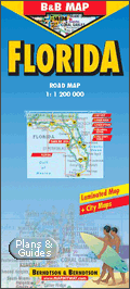
Florida -
Floride |
Florida - B&B Map
Laminated Road Map by Berndtson
Scale : 1:1 200 000
BERNDTSON Map, laminated road map, folded
Detailed Maps:
- Florida 1:1 200 000,
- Key West 1:20 000,
- Miami Downtown 1:20 000,
- South Miami Beach 1:20 000,
- Orlando &
Region 1:200 000,
- Walt Disney World 1:65 000,
- Tampa Bay Area 1:300 000,
- USA Political & Time Zones
Florida - B&B - 1:1 200 000. Road Map. Laminierte
Straßenkarte
Aktuelle, laminierte Straßenkarte mit Kilometrierung,
Geländerelief, Register, mit Plänen der wichtigsten Städte (Miami Downtown,
South Miami Beach, Key West) und Regionalkarten von Orlando, Walt Disney
World sowie Tampa Bay Area. Eine landeskundliche Einführung in 5 Sprachen,
Klimatabelle sowie eine politische USA-Übersichtskarte mit Zeitzonen
ergänzen den Titel. Dieses Produkt ist dank der für Berndtson typischen
Folienbeschichtung extrem robust, reißfest, wasserfest, beschriftbar und
abwischbar sowie endlos faltbar. Weitere Berndtson-Titel USA: Miami, USA6
The South & Florida, New York City, USA-Interstate und viele andere.
B&B Map, Laminierte Straßenkarte, gefaltet
Berndtson & Berndtson
|
|
|
|

Indiana |
Indiana - Rand McNally
Foldmap Rand McNally's redesigned folded map
for Indiana features enhanced cartography showing all Interstate, U.S.,
state, and county highways, along with clearly indicated parks, points of
interest, airports, county boundaries, and streets. The easy-to-use legend
and detailed index make for quick and easy location of destinations, and
there's a mileage chart as well.
Rand McNally folded maps have been the trusted standard for years,
offering unbeatable accuracy and reliability at a great price. This one's a
must-have for anyone traveling in Indiana.
Insets:
- Anderson,
- Bloomington,
- Elkhart,
- Evansville,
- Fort Wayne,
- Gary,
- Indianapolis,
- Greater Lafayette,
- Muncie,
- South Bend, and Terre Haute.
Rand McNally & Company
|
|
|
|


 |
| |
|
|
|
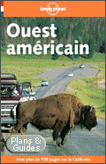
Ouest américain
Guide Lonely PlanetAvec ce guide,
les grands espaces de l'Ouest s'ouvrent à toutes les aventures : à vous
les horizons sauvages des Rocheuses, le vertigineux Grand Canyon, les
splendeurs des déserts californiens, mais aussi les roulettes de Las Vegas...
et les rouleaux du Pacifique !
- onze Etats visités : Colorado, Wyoming,
Montana, Idaho, Nouveau-Mexique, Arizona, Utah, Nevada, Californie,
Washington et Oregon
- un traitement complet des parcs
nationaux et des activités de plein air
- tous les rendez-vous citadins :
San-Francisco, Los Angeles, San Diego, Las Vegas, Albuquerque, Phoenix,
Salt Lake City, Seattle, Denver, Cheyenne...
- des éclairages précis sur l'histoire et
la culture de l'Ouest, de Sitting Bull à Jack Kérouac
- 61 cartes détaillées des villes et des
réseaux routiers régionaux
Editeur : Lonely Planet
Guide de voyage -
Travel Guide
Travel & Holiday guides |
|
|
|
|
| |
|
|


 |
Sud-Ouest Américain
Michelin NEOS Guide
Californie -
Parcs nationaux
Un panorama complet du pays à
travers les paysages, la faune, la flore, les arts, l’histoire et
l’actualité.
Une rencontre avec les habitants dans leur vie quotidienne :
fêtes, religions, musique, cuisine..., accompagnée de quelques clés de
savoir-vivre.
Une exploration approfondie de chaque région, guidée par une
cotation *** rigoureuse.
Plus de 700 adresses d’hôtels et de restaurants, sélectionnées et
adaptées à tous les budgets.
Des carnets pratiques pour chaque étape : transports, santé,
achats, loisirs...
45 cartes et plans en couleurs des régions, des villes et des
sites, avec des propositions d’itinéraires.
This title is written in the
French language. The latest collection of tourist guides offers a
completely new approach to traveling and the chance to experience the
very essence of a destination.
Editeur : Michelin Editions
Collection : Guide Néos |
|
|
|
 |
|
|
|
|

Illinois |
Illinois - Rand McNally
Foldmap Rand McNally's redesigned
folded map for Illinois features enhanced cartography showing all Interstate,
U.S., state, and county highways, along with clearly indicated parks, points
of interest, airports, county boundaries, and streets. The easy-to-use
legend and detailed index make for quick and easy location of destinations.
- Express Access Code: IL
- Points of interest
- State park information
- Mileage chart
- Illinois toll roads
- Road conditions hotlines
- Welcome centers
Rand McNally folded maps have been the trusted standard for years,
offering unbeatable accuracy and reliability at a great price. This one's a
must-have for anyone traveling in Illinois.
Insets included for:
- Bloomington / Normal,
- Champaign / Urbana,
- Chicago & Vicinity,
- Chicago Downtown,
- Decatur,
- Peoria,
- Quad Cities,
- Rockford,
- St. Louis,
- MO & Eastern Metro Area, Springfield.
Rand McNally & Company |
|
|
|

Iowa |
Iowa
- Rand McNally Folded Map Rand McNally
folded maps have been the trusted standard for years, offering unbeatable
accuracy and reliability at a great price. This folded map shows all
Interstate, U.S., state, and county highways for Iowa, with clearly
indicated parks, points of interest, airports, county boundaries, and more.
Casino information, points of interest, scenic route information, state
index, state park chart, and welcome center information is also included.
Detailed indices make for quick and easy location of destinations. It's a
must-have for anyone traveling in and around the state. Measures 9.5" x 4"
and folds out to 40" x 28".
Communities covered: Cedar Rapids, Des Moines, Dubuque, Omaha/Council
Bluffs, Quad Cities, Sioux City, and Waterloo.
Rand McNally & Company
|
|
|
|

Louisiane
Louisiana |
Louisiana - Rand McNally
EasyFinder Map The Louisiana EasyFinder®
features clearly indicated highways, county boundaries, streets, points of
interest, national parks, and more, with a quick-reference legend and a city
index. It's a must-have for navigating the state whether you're a resident
or just passing through.
Durable, convenient Rand McNally EasyFinder® maps will take all the wear
and tear your journey can dish out. The map easily folds to display
individual sections, and eliminates the headache of refolding a paper map in
the car. The laminated design allows you to mark your route, make notes,
then wipe the surface clean for further use.
Publisher: Rand McNally
Travel & Holiday guides
Guide de voyage -
Travel Guide
Landkarte |
|
|
|

|
|
|
|
|

Michigan |
Michigan - Rand McNally
EasyFinder Map The newly redesigned Michigan
EasyFinder® features enhanced cartography with clearly indicated highways,
county boundaries, streets, points of interest, and national parks, along
with a quick-reference legend and city index. The map easily folds to
display individual sections, eliminating the headache of refolding a paper
map in the car.
Durable, convenient Rand McNally EasyFinder® maps take all the wear and
tear your journey can dish out. The laminated design allows you to mark your
route, make notes, then wipe the surface clean for further use. This is a
must-have for navigation whether you're a Michigan resident or just passing
through.
Publisher: Rand McNally
Travel & Holiday guides
Guide de voyage -
Travel Guide
Landkarte |
|
|
|

Nebraska |
Nebraska
- Rand McNally Folded Map Rand McNally's
folded map for Nebraska is a must-have for anyone traveling in and around
the state, offering unbeatable accuracy and reliability at a great price.
Our trusted cartography shows all Interstate, U.S., and state highways,
along with clearly indicated parks, points of interest, airports, county
boundaries, and more.
The easy-to-use legend and detailed index make for quick and easy
location of destinations. This foldmap also features a mileage chart, road
conditions hotline numbers, information on a variety of points of interest,
state park information, and welcome center locations. You'll see why Rand
McNally folded maps have been the trusted standard for years.
Communities covered:
- Grand Island;
- Lincoln;
- North Platte;
- Omaha / Council Bluffs, IA;
- Scottsbluff;
- South Sioux City / Sioux City, IA.
Rand McNally & Company
|
|
|
|

New Jersey |
New Jersey State map
Streetwise
New Jersey State Map Fully indexed and easy to read
with limited access highways (free & toll), divided / primary / secondary
highways, interstate / US / state routes, interchanges and exit numbers,
state boundaries, cities / towns / capitols, places of interest, state parks,
historic state parks and more.
Publisher: Streetwise Maps
Editeur Carrare Eds |
|
|
|

Ohio |
Ohio - Rand McNally
EasyFinder Map The newly redesigned Ohio
EasyFinder® features enhanced cartography with clearly indicated highways,
county boundaries, streets, points of interest, and national parks, along
with a quick-reference legend and city index. The map easily folds to
display individual sections, eliminating the headache of refolding a paper
map in the car.
Durable, convenient Rand McNally EasyFinder® maps take all the wear and
tear your journey can dish out. The laminated design allows you to mark your
route, make notes, then wipe the surface clean for further use. This is a
must-have for navigation whether you're an Ohio resident or just passing
through.
Publisher: Rand McNally
Travel & Holiday guides
Guide de voyage -
Travel Guide
Landkarte |
|
|
|
|
|
|
|
|

Pennsylvania |
Pennsylvania - StreetWise Map
StreetWise Pennsylvania is laminated for durability and
accordion fold for effortless use. The following areas are incorporated into
the map:
Pennsylvania State Map
Fully indexed and easy to read with limited access highways (free / toll),
divided / primary / secondary highways, unpaved roads, scenic routes, trails,
Interstate / US / State routes, interchanges, mileage between points, cities
by population ranges, state capitol, points of interest, state parks,
campgrounds and more.
Area insets include
- Philadelphia,
- Pittsburgh,
- Allentown / Bethlehem,
- Erie,
- Harrisburg.
Perfect for walking tours or quick reference on business trips, the map
gives you comprehensive and accurate street info along with a complete index
of hotels, points of interest, parks, trails, and local transit. The
lamination prevents tearing and is resistant to water in case you get caught
in the rain. Size: 8" x 4".
StreetWise State & County Maps |
|
|
|

Tennessee |
Tennessee Rand McNally
EasyFinder Map: Tennessee
Durable, convenient Rand McNally EasyFinder® maps will
take all the wear and tear your journey can dish out. The map easily folds
to display individual sections, and eliminates the headache of refolding a
paper map in the car. The laminated design allows you to mark your route,
make notes, then wipe the surface clean for further use.
The Tennessee EasyFinder® features clearly indicated highways, county
boundaries, points of interest, national parks, and more, with
quick-reference legend and a city index. It's a must-have for navigating
this part of the country whether you're a state resident or just passing
through.
Rand McNally & Company
|
|
|
|
|
|
|
|
|
|
|
|
|

|
Northwest USA 1 -
Pacific Northwest
Laminated Road Map
by Berndtson - B&B MAP
Scale - Maßstab :1:3 000 000
Einzelkarten - Detailed Maps
Pacific Northwest 1:3 000 000,
San Francisco 1:15 000,
San Francisco Bay Area 1:400 000,
San Francisco & Region 1:1 000 000,
Seattle 1:13 000,
Greater Seattle 1:350 000,
Seattle & Region 1:1 000 000,
Denver & Region 1:1 000 000,
Salt Lake City & Region 1:1 000 000,
Yellowstone N.P. 1:1 000 000,
Northwest - USA 1 -
Pacific Northwest
The beautiful
countrysides of Oregon and Washington - rugged coastline, mountain peaks,
lakes, rivers, rich farmland, and burgeoning wine country as well as the
magnificently situated cities Portland and Seattle - the latter renowned
as "San Francisco of the North" - with their livable cosmopolitan
environments are atrracting more visitors every year. Dominated by the
Rocky Mountains and their foothills, Montana, Wyoming, Idaho, Colorado and
Utah probably contain America's most spectacular scenery, with Yellowstone
NP being the summit: boiling geysers, hot springs, steep canyons, mud
volcanoes, frozen lakes, deep pine forests, dizzying waterfalls,
fossilized trees and fascinating wild life. City highlights include Salt
Lake City, the terminus of the great Mormon trek overland, and Denver, a
thoroughly modern city flat has not entirely shaken off its earlier
heritage as a wild and wooly frontier town.
Northwest - USA 1 - Pacific
Northwest
Die herrlich
gelegenen Städte Portland und Seattle, das auch als "San Francisco des
Nordens" bekannt ist, befinden sich im Herzen der urtümlichen Landschaften
von Washington und Oregon mit ihren Fjorden, Wäldern, kristallklaren Seen
und majestätischen Bergen. Montana, Wyoming, Idaho und Colorado werden
beherrscht von den Rocky Mountains und ihren Ausläufern, eine dramatische
Landschaft, deren Höhepunkt wohl - neben dem Glacier Park in Montana - der
Yellowstone Park darstellt: Geysire, heiße Quellen, tiefe Schluchten,
Schlickvulkane, dichte Wälder, tosende Wasserfälle, versteinerte Bäume und
eine Tierwelt wie aus den Pionierzeiten: Schwarzbär, Grizzly, Büffel und
Bison. Der faszinierende Mormonenstaat Utah mit seiner Vielzahl von
Nationalparks und der einnehmenden Hauptstadt Salt Lake City ist selbst
eine Reise wert.
B&B Map, Laminierte Straßenkarte, gefaltet
Berndtson & Berndtson
|
|
|
|
|
|
|
|
|

|
USA 2 American Southwest Map
Scale:
1:3 000 000
B&B Map, laminated road map, folded
Detailed Maps:
American Southwest 1:3 000 000,
Phoenix & Region 1:1 000 000,
San Francisco Bay Area 1:400 000,
San Francisco Downtown 1:15 000,
Greater Los Angeles 1:225 000,
Los Angeles Downtown 1:20 000,
Las Vegas - The Strip 1:22 000,
Grand Canyon N.P. 1:250 000
From the exciting panorama of San Francisco to the buzzing
megametropolis of Los Angeles or charming San Diego on the Mexican border
- California's coastline not only offers sun, beautiful beaches and
magnificent scenery, but also embodies the true laid-back Californian
lifestyle. Inland, Death Valley's awesome lunar landscapes, the ancient
giant forests of Sequoia NP, and the spectacular waterfalls of Yosemite NP
are further spectacular attractions. Las Vegas, the "Gambling Capital", in
nearby Nevada, witnesses more than 60.000 marriages anually, performed
between Black Jack and Roulette, of course. Further east, the splendid
desert city of Phoenix would serve as a wonderful base for excursions to
one of the seven wonders of nature: the meandering gorges of the Colorado
River, the Grand Canyon. New Mexico reflects images of the Old West:
forest-clad mountains, vast open prairies, ancient Indian pueblos and
ruins, and historic Spanish towns.
USA 2 American Southwest
Kaliforniens Küste zwischen San Franciscos
herrlichem Hafenpanorama und der hektischen Megametropole Los Angeles hat
nicht nur Sonne, herrliche Strände und eine abwechslungsreiche Landschaft
zu bieten, sondern ist zugleich auch ein Inbegriff entspannten
kalifornischen Lebensstils; weitere Unvergeßlichkeiten gibt es in den
Nationalparks zu bewundern: die uralten Baumriesen im Sequoia NP, die
monumentalen Wasserfälle im Yosemite NP und die Mondlandschaften von Death
Valley. In der funkelnden Spielhölle Las Vegas im Nachbarstaat Nevada
werden - zwischen Black Jack und Roulette - jährlich unter anderem 60.000
Hochzeiten zelebriert. Weiter östlich lockt die glänzende Wüstenstadt
Phoenix, von der aus es nicht mehr weit zum gigantischen
Schluchtenlabyrinth des Grand Canyon ist. Seinen ganz eigenen Zauber
besitzt New Mexico: Mit seinen weiten Prärien, uralten indianischen Ruinen
und historischen spanischen Städten wirkt es wie die Kulisse zu einem
alten Western.
B&B Map, Laminierte Straßenkarte, gefaltet
Berndtson & Berndtson
|
|
|
|
|
|
|
|
|

|
USA 4 : Texas & South Central
Laminated Road Map
by Berndtson - B&B MAP
Scale:1:3 000 000
B&B Map, laminated road map, folded
Detailed Maps:
Texas & South Central 1:3 000 000,
Greater Dallas 1:1 000 000,
Greater Houston 1:1 000 000,
Greater Memphis 1:1 000 000,
Big Bend & Surroundings 1:1 000 000
USA 4 Texas & South Central
A vast dusty plain swarming with
cattle and dotted with cities of glittering mirrow-glass skyscrapers,
inhabited by men with wide-brimmed Stetsons, either on horse or somewhere on
the 30th floor ruling from a desk that covers the area of a middle-sized
swimming pool - there is some truth in the TV image of America's second
largest state. The things still to be mentioned include Dallas' renowned
symphony orchestra and Houston's excellent museums and performing arts scene
plus the nearby Johnson Space Center, and, above all, the beautiful
diversity of the scenery: the long, sandy beaches of the gulf shoreline, the
dense forests and clear lakes in the east of Dallas, the rugged canyon
country around Amarillo and, west of the Pecos River, the dramatic desert
and mountain scenery that includes the Guadalupe Mountains and Big Bend
National Parks; wherever you go, Texas in reality is just a little bigger
and more beautiful than on TV!
USA 4 Texas & South Central
Eine weite Ebene, auf der die
Viehherden unter Staubwolken dahinziehen und Städte aus spiegelnden
Wolkenkratzertürmen, beides beherrscht von Männern in Cowboystiefeln und -hüten,
entweder zu Pferde oder hinter einem Mahagonischreibtisch von der Größe
eines mittleren Schwimmbeckens - die Fernsehwahrheit über Texas enthält ein
Körnchen Wahrheit. Man braucht nur noch das hervorragende Symphonieorchester
von Dallas zu erwähnen sowie das reichhaltige Kulturangebot von Houston, das
nahe bei Houston gelegene Johnson Space Center und vor allem die herrliche
Landschaft: die langen Sandstrände an der Golfküste, die dichten Wälder und
kristallklaren Seen im Osten von Dallas, die spektakulären Canyons um
Amarillo und die Naturparks Big Bend und Guadalupe Mountains westlich des
Pecos mit ihrer dramatischen Wüsten- und Berglandschaft.
B&B Map, Laminierte Straßenkarte, gefaltet
Berndtson & Berndtson
|
|
|
|

|
| |
|
|

|
NELLES GUIDE USA : Westküste, Rocky
Mountains, der Südwesten
- 144 Farbbildern
- 21 Karten / Stadtplänen
Reiseziele: Wählen Sie unter 15 individuell zusammengestellten Routen
quer durch den Westen der USA. Unsere Autoren führen Sie von Los Angeles
und San Francisco aus durch Kalifornien; durch die Rocky Mountains, die
Indianerreservate und Geisterstädte im Südwesten. Von Seattle aus wird der
Nordwesten bis nach Kanada und zum Yellowstone-Nationalpark erkundet.
Die USA gelten als „Land der unbegrenzten Möglichkeiten”. Doch der
Wilde Westen ist gezähmt, die Cowboys arbeiten auf Gästefarmen, und die
Indianer haben das Kriegsbeil begraben. Kalifornien, einst Ziel der
Goldsucher und später der Hippies, ist heute High-Tech Region. Der Nelles
Guide macht Sie mit dem American Way of Life vertraut.
Nelles Verlag |
|
|
|

|
NELLES GUIDE USA : Ostküste,
Mittlerer Westen, Südstaaten
- 146 Farbbildern
- 24 Karten / Stadtplänen
Wählen Sie unter 14 individuell zusammengestellten Routen quer durch
den Osten und den Mittleren Westen der USA. Amerikanische und deutsche
Autoren führen Sie von New York durch Neuengland; zu den Großen Seen, nach
Chicago und von dort in die Weiten der amerikanischen Prärie; sowie von
Washington, D.C. durch die Südstaaten bis nach Florida.
Die USA gelten als das „Land der unbegrenzten Möglichkeiten”. Erleben
Sie den Mythos der Highways, der das Genre der Road Movies hervorbrachte.
Der Nelles Guide macht Sie mit dem American Way of Life und der
amerikanischen Mentalität vertraut – dem Spannungsfeld zwischen Freiheit
und Moralvorstellungen, die auf Europäer manchmal prüde wirken.
Konkrete Reisehinweise am Buchende helfen bei der Urlaubsvorbereitung:
Von der besten Reisezeit über den richtigen Mietwagen und die
Alltagskultur bis hin zur gekonnten Essensbestellung.
Nelles Verlag |
|
|
|
|
| |
|
|

Virginia |
Virginia - National
Geographic Guide Map More than the usual
folded state map, National Geographic's Guide Map for Virginia offers
detailed statewide coverage as well as destination info in a portable
format. It has suggestions for things to see and do, with listings of sights,
events, scenic drives, and much more.
Inset maps and highway maps will help you get from place to place,
and the descriptions will provide ideas for spontaneous detours. It's
a great road trip companion. Measures 9" x 4" folded.
Publisher: MapQuest.com
Rand McNally & Company
|
|
|
|

Washington |
Washington State - Rand
McNally Foldmap Rand McNally's redesigned
folded map for Washington features enhanced cartography showing all
Interstate, U.S., state, and county highways, along with clearly indicated
parks, points of interest, airports, county boundaries, and streets. The
easy-to-use legend and detailed index make for quick and easy location of
destinations.
Rand McNally folded maps have been the trusted standard for years,
offering unbeatable accuracy and reliability at a great price. This one's a
must-have for anyone traveling in and around Washington.
Inset maps include: Bellingham, Mt. Rainier Nat'l. Park, Olympia, Seattle
& Vicinity, Seattle Downtown, Spokane, and Yakima.
Publisher: Rand McNally
Travel & Holiday guides
Guide de voyage -
Travel Guide
Landkarte |
|
|
|
|
| |
|
|
|
|
|
|
|

|