|
|
Destination :
District of Columbia -
Washington DC
Tourism and Travel
- Tourisme - Voyage - Reiseführer nach Reihen
United States of America -
États-Unis d'Amérique - Vereinigte Staaten von Amerika
|
|
|
|
|
|
|


 |
Washington, DC - National
Geographic Destination Map National
Geographic's Destination Map™ for Washington, DC features detailed city maps
plus useful travel information, perfect for the active urban adventurer.
- Tear-resistant lamination
- Regional, airport, and transit maps
- Travel tips and local cultural information
- Legends in English, French, Italian, and Spanish
- 3-D views of landmark buildings This is a world-class map for a
world-class city. It's great for trip-planning and reference while touring
Washington, DC. Size: 9" x 4.5" (folded).
Publisher: MapQuest.com
Rand McNally & Company |


 |
|
|
|
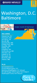
Baltimore,
Washington, D.C -
Rand McNally Foldmap Rand McNally folded maps have been
the trusted standard for years, offering unbeatable accuracy and reliability
at a great price. This folded map shows all Interstate, U.S., state, and
county highways for the Baltimore/Washington, D.C. area, with clearly
indicated parks, points of interest, airports, county boundaries, streets,
and more. Inset maps of Central Baltimore, Central Washington, D.C.,
Baltimore/Washington International Airport, Ronald Reagan Washington
National Airport, and Washington Dulles International Airport are included.
Detailed indices make for quick and easy location of destinations. It's a
must-have for anyone traveling in and around the capital region. Measures
9.5" x 4" and folds out to 40" x 28".
Communities covered: Alexandria, VA; Annapolis, MD; Arlington, VA; Bowie,
MD; Cantonsville, MD; College Park, MD; Dundalk, MD; Fairfax, VA; Frederick,
MD; Gaithersburg, MD; Herndon, VA; Leesburg, VA; Manassas, VA; Rockville, MD;
and Towson, MD.
Rand McNally & Company |
|
|
|
|
|
|
|
|
|
|
|
|
|
|
|
|
|

 |
|
|
|
|

|
Washington, D.C - Rand
McNally Foldmap
Virginia & Maryland : Local Street Detail
Rand McNally folded maps have been the trusted
standard for years, offering unbeatable accuracy and reliability at a great
price. This folded map shows all Interstate, U.S., state, and county
highways for the Washington, D.C. area, with clearly indicated parks, points
of interest, airports, county boundaries, streets, and more. Inset maps of
The Mall and Washington, D.C. & Vicinity are included, along with a mileage
& driving times map.
Detailed indices make for quick and easy location of destinations. It's a
must-have for anyone traveling in and around our nation's capital. Measures
9.5" x 4" and folds out to 40" x 28".
Communities covered: Alexandria, Berwyn Heights, Bladensburg, Cheverly,
Chevy Chase, Chevy Chase View, College Park, District Heights, Fairmount
Heights, Falls Church, Glenarden, Greenbelt, Hyattsville, Kensington, Mount
Rainier, New Carrollton, Riverdale Park, and Takoma Park.
Publisher: Rand McNally
Travel & Holiday guides
Guide de voyage -
Travel Guide
Landkarte |
|
|
|

 |
Washington, DC Metro - Thomas
Guide
The Washington, D.C. Thomas Guide® provides the most
highly accurate, richly detailed mapping available for the area.
Easy-to-read, contiguous street-level maps cover the entire county, with a
portrait-style layout and spiral binding for maximum convenience on the go.
- Full coverage for all cities & communities
- Easy-to-use Page & Grid System
- Township tier, range, and section numbers
- Fully indexed points of interest
- Includes the Thomas Guide DigitalEdition
The content has been fully updated, and includes ZIP codes, boundaries,
and transit information, as well as a complete street index. The Thomas
Guide is your navigational bible around our nation's capital.
Communities covered: Alexandria, Bowie, Capitol Heights, College Park,
District Heights, Fairfax, Falls Church, Gaithersburg, Glenarden, Greenbelt,
Kensington, Laurel, Laytonsville, Leesburg, Manassas, Morningside, Mount
Airy, New Carrollton, Rockville, Round Hill, Seat Pleasant, Somerset, Takoma
Park, and Washington, D.C.
Publisher: Rand McNally
Travel & Holiday guides
Guide de voyage -
Travel Guide
Landkarte |
|
|
|

|
|
|
|
|
City map USA
Plan de ville USA |
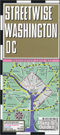
 Washington Dc Streetwise
Streetwise Map
Plan de Ville de Washington
Dc
La ville, le Mall, les transports en commun
et toute la région.
Plastifié,
clair, lisible, esthétique, pratique et complet (index avec liste des rues,
hôtels, sites touristiques, musées, monuments, salles de concert,
mémoriaux, administrations, shopping, etc.).
Washington Dc
Laminated for
durability, accordion folded to fit in your pocket or purse,
Streetwise (r) gives you Washington Dc in a clear, concise, and convenient
format.
StreetWise® Maps are incredibly durable laminated maps
that are thoroughly detailed and also quite easy to read. This
accordion-style map of Washington, DC is pleated to give the map an
instantly engaging display that tucks neatly away to fit into your pocket,
purse, briefcase, or even day planner.
Perfect for walking tours or quick reference on business trips, the map
gives you comprehensive and accurate street info along with a complete index
of hotels, points of interest, parks, trails, and local transit. The
lamination prevents tearing and is resistant to water in case you get caught
in the DC rain. Size: 8" x 4".
City map - Town Plan
|


|
|
|

|
Washington, DC City Map
Lonely Planet
- D.C. & Environs
- Downtown & Mall Areas
- Washington, D.C. Excursions
- Central Washington
- Washington Metro Map
- Unique Lonely Planet Walking Tour
- Index of all Streets & Sights
- Essential Information
Washington, DC
Stadtplan - Plan de ville - City map
Editeur : Lonely Planet
Travel & Holiday guides |
|
|
|
 |
|
|
|
|

|
Washington, DC - Lonely
Planet Witness American democracy in action
in its cosmopolitan capital city, Washington DC, where power-lunching suits
seal deals in downtown hotels, flags flap along the National Mall, and grand
marble monuments testify to two centuries of American history. Our smart,
streetwise guide gives expert insight on DC’s international culture and
contemporary offerings.
- BE INSPIRED – scale the Washington Monument, tour the White House,
touch a moon rock at the Air & Space Museum, reflect at the World War II
Memorial
- SEE THE SIGHTS – walking tours uncover DC history & help you explore
day-to-day neighborhood life
- FIND THE FUN – nightlife options for all preferences: Kennedy Center
galas, Georgetown pubs, downtown galleries, Dupont Circle nightclubs
- DINE ABOUT – dig into DC’s ever-evolving culinary scene, with menus
for all budgets
- GET AWAY – cross the Potomac to Arlington and Alexandria; travel
further to Mount Vernon, Annapolis, Manassas and Shenandoah National Park
Editeur : Lonely Planet
Travel & Holiday guides |
|
|
|

|
Washington, DC - Michelin
Green Guide
This updated edition of a popular title in Michelin
acclaimed collection of travel publications is your key to Washington's
renowed monuments, museums and attractions.
From the steps of the revered Lincoln Memorial to the corridors of the
Capitol building, from the historic rooms of the White House to the exhibit
halls of the National Air and Space Museum, form the gravesites at Arlington
National Cemetery to the streets of Embassy Row, let Michelin help you
discover the nation's capital.
Excursions from DC highlight the best of Alexandria and the Mount Vernon
area in nearby Virginia.
Editeur : Michelin - Le guide vert
Guide de voyage -
Travel Guide
Travel & Holiday guides |
|
|
|

Miniature, vignette, imagette, thumbnail
|
|
|
|
|


|
Washington D. C. und Umgebung, Marco Polo,
Reisen mit Insider-Tipps. Jetzt mit Cityatlas Washington
D.C
Marco Polo Reiseführer enthalten - neben den wichtigen Infos über
Formalitäten von Auskunft bis Zoll - Hinweise auf Hotels, originelle
Restaurants, Kneipen, Diskotheken und Jazzkeller auch abseits vom normalen
Tourismus. Sie erschließen Ihnen Sehenswürdigkeiten aller Art.
Marco Polo Reiseführer nennen eine Vielzahl von Tipps für die
individuelle Urlaubsgestaltung.
Mit Insider-Tipps, Cityatlas
Washington D.C. -
Marco Polo Travel Guides
MapEasy's Guidemap to Washington D.C. shows detail
maps for Georgetown/Dupont Circle, Old Town Alexandria, Out-of-Town Trip,
and the METRO. It is a location map and guidebook in one. Each hand-drawn
Guidemap contains useful facts on hotels and restaurants, as well as
information regarding shops, museums, and attractions. MapEasy's Guidemap to
Washington D.C. is made of a waterproof, tear resistant material.
Mapart Publishing
|
|
|
|

|
Washington City
Streets
Washington D. C.
Stadtplan - Plan de ville - City map
Maßstab - Scale - Echelle
1:15 000
BERNDTSON City Streets, laminated city map, folded
Detailed Maps:
Washington City 1:15 000, Washington & Region 1:200 000, The Mall 1:13 000,
Washington Metro Rail System,
Washington D.C. Street System
B & B City Streets, Washington D. C.
Aktuelle, laminierte Straßenkarte mit diversen
Nebenkarten samt Register, einer Nahverkehrskarte und einer Auswahl der
wichtigsten Sehenswürdigkeiten. Dieses Produkt ist dank der
Folienbeschichtung extrem robust, reißfest, wasserfest, beschriftbar und
abwischbar sowie endlos faltbar. Weitere Berndtson-Titel zu den USA: New
York City, Philadelphia, Boston, Atlanta und viele mehr.
B&B Map, Laminierte Straßenkarte, gefaltet
Berndtson & Berndtson
|
|
|
|

|
|
|
|
|
 |
Eastern United States
Rand McNally Foldmap
Rand McNally's redesigned folded map for the Eastern US
features enhanced cartography showing all Interstate, U.S., state, and
county highways, along with clearly indicated parks, points of interest,
airports, county boundaries, and streets. The easy-to-use legend and
detailed index make for quick and easy location of destinations.
Rand McNally folded maps have been the trusted standard for years,
offering unbeatable accuracy and reliability at a great price. This one's a
must-have for anyone traveling in and around the Eastern US.
Covers
- Alabama,
- Connecticut,
- Delaware,
- District of Columbia,
- Florida,
- Georgia,
- Indiana,
- Kentucky,
- Maine,
- Maryland,
- Massachusetts,
- Michigan,
- New Hampshire,
- New Jersey,
- New York,
- North Carolina,
- Ohio,
- Pennsylvania,
- Rhode Island,
- South Carolina,
- Tennessee,
- Vermont,
- Virginia, and West Virginia.
Insets of major cities and a mileage chart are included.
Rand McNally & Company
|
|
|
|

|
|
|
|
|

 |
Topo USA 5.0 National DVD
DeLorme Topo USA 5.0 DVD
DeLorme Topo USA 5.0 gives you amazing
tools to help plan your outdoor adventures, on and off the road. Brilliant,
detailed topographical mapping is provided for the entire U.S., complete
with elevation data, rivers and streams, and more than 300,000 trail miles.
Topo 5.0 offers many new and updated features that make it the best version
yet of Topo USA. This DVD version means no switching discs when you need to
access different information!
- Create automatic routes by trail or road
- Automatically download your GPS track files as routable roads or
trails
- New 3-D views let you look around from where you stand as well as out
to where you're heading; You even can see the free imagery rendered on a
realistic 3-D map
- Customize and print maps to take along or help plan
- Get profiles for roads, trails, and waterways
- Use freehand drawing tools to trace routes on the maps
- Includes the most recent national street network available from
DeLorme
- Free CD included shows breathtaking aerial imagery of a variety of
national places of interest
- Access and download DeLorme campground information from 16,107 State
and National Parks
- FREE download of $50 worth of Aerial Data Packets (ADPs), including
up-to-date aerial photos (DOQQs), 10-meter color satellite images, and
scanned USGS 7.5-minute topographic maps (free downloads only available
via Web download from the DeLorme 4-terabyte server)
Topo USA makes it easy and fun to plan camping trips, hikes, or
just about any other excursion.
System requirements: Microsoft® Windows® 95/98, or Windows NT® 4.0 or
later; PC with Intel® Pentium® 150 or higher processor; 32 MB RAM; 300 MB of
RAM of available hard-disk space; DVD-ROM drive; 16-bit color monitor with
Super VGA graphics; mouse.
DeLorme |
|
|
|
 |
|
|
|
|
|
|
|
|
|

|
USA
phrasebook, (en anglais)
de Lonely PlanetFrom
Tinseltown's glitter to the charm of the South, decode the jargon and
discover the culture of the USA. Compare Big Apple speed-speech with the
laidback Texan drawl. Identify the multitude of regional and social
dialects and influences on the language along the way.
- learn to order a splash of red noise in a diner or request your
coffee unleaded
- understand dialects from SoFlo to Yooper, and hear the echoes of
Shakespeare
- expand your musical horizons with a comprehensive guide - from
rock'n'roll to techno
- immerse yourself in the language melting pot - from US Spanish &
Asian languages to African-American English & Yiddish
- includes Native American languages & Hawaiian
Phrasebooks
Phrasebooks cover the essential words and phrases travellers may need.
These pocket-sized language guides include colour tabs for quick reference,
extensive vocabulary lists, easy-to-follow pronunciation keys and two-way
dictionaries.
Editeur : Lonely Planet
Travel & Holiday guides |
|
|
|


|
Anglais ou Américain
? Les différences à connaître
L'anglais britannique et l'anglais américain, deux variantes d'une même
langue qui se distinguent par le vocabulaire, l'orthographe, la
prononciation et, sur certains points, par la grammaire. Cet ouvrage a
pour vocation de vous permettre de passer rapidemment de l'un à l'autre et
d'éviter ainsi les incompréhensions que ces différences peuvent provoquer.
Un guide de 94 pages
Guide de conversation
Editeur Assimil
Collection Langue De Poche |
|
|
|
|
| |
|
|

Livre + 4 CD Audio
|
L'Américain sans peine
Assimil - Collection Sans PeinePour tous
ceux qui veulent se servir dès le départ de l'anglais américain comme
langue internationale, Assimil a créé cette authentique (et humoristique)
introduction à la langue et à la culture américaines. Tout en vous
enseignant la langue, notre méthode vous donne un aperçu plus familier du
pays et de ses habitants.
Un livre relié-cousu de 105 leçons en 608 pages et 4 CD d'une durée de
2h45
Débutant, Faux débutant, Remise à niveau
Collection "Sans peine"
Série essentielle d’ASSIMIL, elle permet en quelques mois d'acquérir
plus 2000 mots de vocabulaire, la grammaire de base et de maîtriser la
conversation courante dans plus de cinquante langues.
Editeur Assimil - Langue
Collection Langue Sans Peine |
|
|
|

|
Pack Tell Me More Anglais,
niveaux 1+2+3
AuralogTell Me More, véritable
logiciel intelligent capable d'analyser vos progrès en temps réel, vous
proposera l'activité la plus pertinente par rapport à vos besoins.
Quels que soient vos objectifs et votre niveau, du vrai débutant au
professionnel confirmé, Tell Me More s'adapte à vos besoins et accompagne
vos progrès tel un véritable professeur de langues. Des parcours de
travail dédiés à la préparation des Certificats Européens de Langues vous
permettront de vous entraîner selon les niveaux définis par le Conseil de
l'Europe.
Référence mondiale des logiciels d'apprentissage de
langue étrangères, Tell Me More est à la fois apprécié par les
professionnels de l'enseignement pour son utilisation intensive de la
reconnaissance vocale ainsi que ses parcours pédagogiques pour un
apprentissage personnalisé : le Ministère de l'Education Nationale a
décerné le label " Reconnu d'Intérêt pédagogique " à la version éducation
de Tell Me More pour plusieurs langues.
Approche pédagogique à la carte -
3 modes de travail :
- Mode Libre
(pour un apprentissage à votre convenance),
- Mode Guidé
(en fonction de vos priorités d'apprentissage et vos disponibilités),
- Mode Dynamique
(optimise l'apprentissage en s'adaptant à vos progrès et vos objectifs
de départ)
Contenu riche et varié
750 heures d'apprentissage
37 types d'activités (sur les ateliers Thématique, Culture, Grammaire,
Vocabulaire, Oral et Ecrit)
Tutorat gratuit en ligne (les tuteurs du forum Club Auralog complètent
votre apprentissage en cas de question)
Technologies de dernière génération
Reconnaissance vocale de référence (Le système S.E.T.S.
vous permet de retravailler vos erreurs de prononciation)
Vidéo et dialogues interactifs
Interface moderne et ergonomique
|
3 niveaux |
Années d'études
de la langue
|
Equivalence scolaire
|
|
Débutant
|
0-2
|
COLLÈGE
|
|
Intermédiaire
|
2-4
|
LYCÉE
|
|
Confirmé
|
4 +
|
Bac à Bac +2
|
3 niveaux
- Débutant
(0 à 2 ans d'études de la langue, Niveau A1/A2 du Certificat Européen de
Langues, niveau Collège)
- Intermédiaire
(2 à 4 ans d'études de la langue, Niveau B1 du Certificat Européen de
Langues, niveau Lycée)
- Confirmé
(4 ans d'études de la langue, Niveau B2 du Certificat Européen de
Langues, niveau Bac à Bac +2)
Editeur : AURALOG
Educatif / langues / Anglais |
|
|
|
|
|
|
|
|

|
|
|
|
|
 |
|
|
|
District of
Columbia
Capitale : Washington
|
|
Cities - Villes
|
|
|
|
|
|


 |
|
 |


